
Digital dashboards
Dashboards for historical and real-time data at our
Groundwater Research and Teaching Observatory
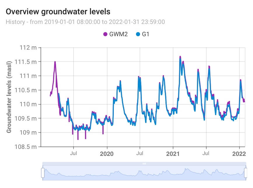
Groundwater levels
Groundwater levels in our observation wells with comparison and long-term analysis
Datasets with water levels and water quality monitoring in our observation wells, including results of different tests and manual measurements.
Groundwater levels in single observation wells
Comparison of water levels in different wells
Long-term groundwater monitoring data
Trends and statistical analyses
Water quality
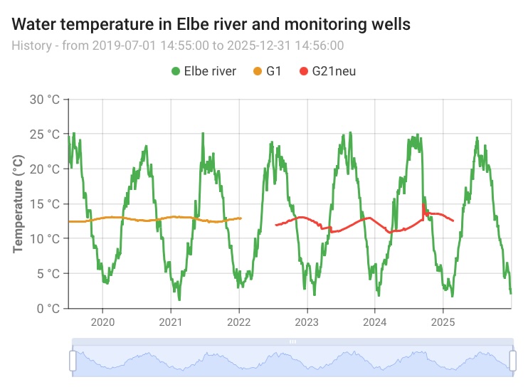
Water quality parameters in groundwater and nearby surface water bodies (Elbe river).
Tracks physico-chemical indicators in groundwater and the Elbe river to assess contamination risks and natural water quality dynamics.
Temperature, pH, electrical conductivity
Dissolved oxygen, redox potential
Turbidity and total organic carbon (TOC/DOC)
Specific parameters of concern (point data)
Sampling location (well number, river)
River-groundwater interaction
Real-time and historical comparison of datasets on groundwater levels and Elbe river stages.
Compares groundwater and Elbe river stage to characterise gaining/losing conditions and the influence of river dynamics on the aquifer.
Elbe water level and discharge (gauging station Pirna)
Groundwater levels in near-river wells
Hydraulic gradient between river and aquifer
Bank filtration travel-time indicators
Flood and low-flow event markers
Water temperature in river and wells

Groundwater modeling
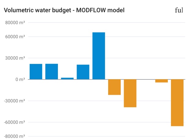
Results of our groundwater flow modeling using MODFLOW at test field site.
Integrates monitoring data with numerical model outputs to visualise flow directions, velocities, and predictive scenarios.
Hydraulic head distribution
Modelled vs. observed heads (calibration plots)
Scenario simulations (pumping, recharge, climate)
Model residuals and uncertainty
Volumetric water budgets
Boundary condition inputs
Direct-push EC profiling
Vertical electrical conductivity profiles for characterising the subsurface hydrochemical conditions.
EC profile logs contain continuous measurements of electrical conductivity collected at different depths within a monitoring well. These datasets help identify changes in groundwater salinity, stratification, lithological boundaries, inflow zones, and hydrogeological heterogeneity. EC profiling is widely used in groundwater investigations, environmental monitoring, aquifer characterisation, and managed aquifer recharge studies.
Dashboard →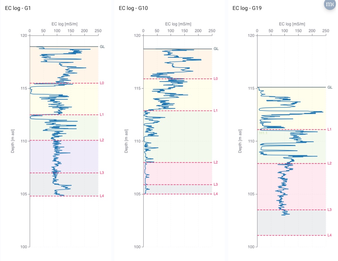
ThingsBoard.io
Our dashboards were created using ThingsBoard.io, an open-source platform designed for collecting, processing, and visualising data from connected devices and sensors.